Germany’s $2B SAR satellite deal pairs persistent ISR with AI image analysis. See what it signals for defense autonomy, tracking, and faster intel cycles.
Germany’s $2B SAR Satellite Bet: AI ISR at Scale
€1.7 billion is a loud number in any defense budget. In space budgets, it’s a statement of intent.
Germany just put that intent on paper by awarding a roughly €1.7B (about $2B) contract to ICEYE and Rheinmetall to build and operate a new synthetic aperture radar (SAR) satellite constellation. The headline isn’t “more satellites.” The headline is persistent reconnaissance at operational tempo, with AI-driven image evaluation built into the service.
If you work anywhere near national security, you already know the pressure: commanders want actionable intelligence faster; analysts want fewer false alarms; procurement teams want resilient access without betting the farm on one exquisite platform. Germany’s move is a clean case study in where AI in defense and national security is heading next—toward high-volume sensors + automated exploitation + tighter tasking loops.
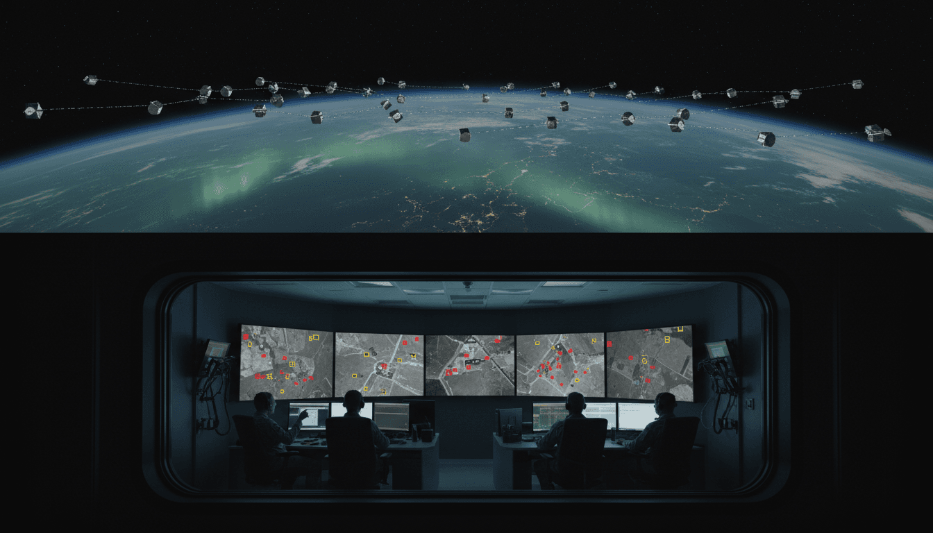
Germany’s SAR contract is really about persistence, not pictures
Germany’s award to Rheinmetall and ICEYE is a direct investment in persistent operational tracking, not a vanity constellation.
The program is for a low Earth orbit constellation called SAR Space System for Persistent Operational Tracking Stage 1 (SPOCK 1). The contract runs from the end of 2025 through 2030, with options to extend, and production of the first satellite is planned to start in Q3 2026.
Why SAR (again) — and why now
SAR matters because it sees what optical often can’t: clouds, smoke, low light, and bad weather don’t shut it down. That’s not academic. In Northern and Eastern Europe—especially through winter—optical-only ISR can become a calendar game.
Germany also knows the limits of “make do.” Its existing SAR-Lupe satellites were launched 2006–2008. Follow-ons (SARah) had well-publicized issues until antenna deployment recovery brought them into service. So this is a modernization decision, but it’s also a shift in operating model: SPOCK 1 is framed as a service solution including constellation ops, ground station management, and AI-driven image evaluation.
The tactical driver: NATO’s eastern flank
The stated primary use is to support protection of Germany’s Lithuania Brigade (45th Armoured Brigade) and contribute to securing NATO’s eastern flank. That’s a tell.
It signals that space-based ISR is no longer treated as “strategic overhead.” It’s being purchased as a tactical instrument—something you task, exploit, and re-task on timelines that match maneuver forces.
“AI-driven image evaluation” is the real capability jump
A SAR constellation only creates advantage if you can turn data into decisions fast. AI is what makes “high-volume SAR” usable.
SAR imagery is information-rich but cognitively expensive. Interpreting it at speed—across wide areas, repeated passes, and multiple mission sets—demands automation. When vendors advertise AI-driven imagery evaluation, they’re usually talking about a stack that looks like this:
- Automated detection (e.g., vehicles, vessels, aircraft on aprons, construction activity)
- Change detection between time-separated collects (what moved, what appeared, what disappeared)
- Pattern-of-life baselining (what “normal” looks like at a site) and anomaly detection
- Confidence scoring and triage to route the right alerts to the right analysts
- Human-in-the-loop tooling to confirm, correct, and retrain models
Here’s the stance I’ll take: buying satellites without buying exploitation is paying for noise. Germany’s contract language suggests the opposite—an intent to buy the pipeline, not just the pixels.
Near-real-time ISR is a workflow problem
Near-real-time ISR isn’t a single technology. It’s a chain:
- Tasking (who asks for what, with what priority)
- Collection (satellite availability, orbit, constraints)
- Downlink (ground stations, latency)
- Processing (SAR focusing, calibration, geolocation)
- Exploitation (AI + analysts)
- Dissemination (getting it into C2 tools and mission planning)
- Re-tasking (closing the loop)
The German approach—constellation plus ground segment plus AI evaluation—targets steps 3 through 6, where most organizations actually lose time.
Europe’s “strategic autonomy” push is turning into procurement reality
Europe has talked about strategic autonomy for years. This contract is what it looks like when the talking stops.
Germany’s award lands after Berlin signaled a broader €35B space security investment plan. It also sits alongside ICEYE’s recent sales to other European militaries, which—taken together—show a pattern: European defense organizations are moving from “data subscriptions” toward sovereign or semi-sovereign ISR stacks.
What changes when the operator also owns the constellation
In SPOCK 1, the firms will own and operate the constellation, delivering imagery to the German military. That matters because ownership and operations determine:
- Tasking priority during crises
- Data rights and retention (who stores what, where, and for how long)
- Model training access (can you train AI on your own labeled mission data?)
- Resilience posture (redundancy, surge capacity, replacement strategy)
It also raises a hard question that procurement teams should ask early: how do you prevent vendor lock-in at the AI layer? If your detection models, labeling tools, and workflows are proprietary, switching providers later can be slower than launching new satellites.
What a modern SAR + AI ISR stack enables (beyond “imaging”)
Persistent SAR with AI exploitation supports missions that are difficult to sustain with optical-only, human-only analysis.
1) Persistent operational tracking
The phrase “persistent operational tracking” is doing a lot of work here. In practical terms, that often means monitoring:
- Border-area logistics flows (vehicle concentrations, staging areas)
- Training area utilization and readiness signals
- Infrastructure changes (trenches, berms, revetments, new road cuts)
- Maritime activity patterns and port throughput indicators
SAR is especially useful for repeatable monitoring because it’s less sensitive to lighting and weather variation.
2) Deception-resistant change detection
Deception and camouflage are real, but they’re not magic. The advantage of AI-assisted SAR change detection is that it can surface second-order signals that people miss at scale—consistent ground disturbance, repeated movement routes, or “too regular” patterns around decoys.
AI won’t solve deception by itself. But it does one crucial thing: it forces the adversary to manage their signature continuously, not just during photo-op hours.
3) Faster target development—if you engineer trust
AI-enabled ISR only works operationally if decision-makers trust it. That trust doesn’t come from marketing claims; it comes from measurable performance and transparent workflows.
If you’re building an AI ISR pipeline (or buying one), insist on operational metrics such as:
- Probability of detection by target class
- False alarm rate per square kilometer or per scene
- Time-to-alert from collection to analyst queue
- Model drift checks across seasons, terrain types, and sensor configurations
- Explainability artifacts (why the model flagged this region)
A good rule: if the vendor can’t talk about these metrics without squirming, they’re not ready for your mission.
The procurement lesson: Germany is buying a “kill chain enabler,” not a sensor
Most defense organizations still buy ISR like it’s 2008: platform first, exploitation later, integration last.
Germany’s contract is notable because it bundles the pieces that make ISR operationally relevant: operations + ground + AI exploitation. That’s closer to buying an outcome: persistent awareness with manageable analyst load.
What to copy (and what to challenge) in your own ISR AI program
If you’re responsible for capability planning, acquisition, or modernization, here’s what I’d copy from this model:
- Contract for tempo: specify revisit expectations, latency targets, and surge behavior during crises.
- Treat AI as part of ISR, not an add-on: require model evaluation in realistic conditions.
- Plan the ground segment like it’s a weapon system: redundancy, cybersecurity, and continuity matter.
And here’s what I’d challenge up front:
- Data governance: where does data live, who can access it, and what’s the retention policy?
- IP and portability: can you export labels, detections, and trained models if you change providers?
- Integration: how will alerts and imagery land inside your operational C2 and mission planning tools?
A blunt truth: the “AI ISR advantage” goes to the side that can integrate detections into operations without turning analysts into a bottleneck.
Where this goes next in AI for defense and national security
This deal is a marker for the next phase of military space: proliferated sensing plus automated exploitation tuned to real operational requirements.
Over the next few years, expect three pressures to intensify:
- Latency becomes a procurement metric (not just resolution). Minutes matter more than centimeters for many missions.
- Model assurance becomes a command issue. If leaders can’t trust automated alerts, they won’t act on them.
- Counterspace resilience is non-negotiable. Proliferation helps, but only if the ground segment and data paths are equally robust.
If your organization is exploring AI in ISR—especially for SAR, change detection, and operational tracking—this is the right moment to audit your pipeline end-to-end. Satellites are the easy part to admire. Workflows are where capability actually lives.
If you’re building toward a future where AI supports mission planning, threat detection, and real-time reconnaissance, ask a simple question: Can we turn raw sensor data into a decision faster than the adversary can move?