Fast image geolocation AI can place photos in ~0.0013s using a 35MB model—useful for GPS-degraded utility work and defense analysis.
Fast Image Geolocation AI for Utilities and Defense
A 35 MB computer vision model that can geolocate a street-level photo in about 0.0013 seconds should get the attention of anyone who depends on reliable positioning—especially when winter storms, wildfires, or adversarial interference make GPS less trustworthy.
The headline claim from recent research published in IEEE Transactions on Geoscience and Remote Sensing is straightforward: a faster, smaller image geolocation model can match a ground photo (a building, street corner, substation fence line) to an aerial image database with high accuracy—up to 97% for narrowing down the right area in an initial stage, and about 82% when pinpointing an exact location.
In our AI in Defense & National Security series, we often talk about “resilience” as if it’s a single feature. It isn’t. Resilience is a stack: sensors, models, data, comms, and operations. Image-based geolocation sits in that stack as a practical fallback when metadata is missing, GPS is degraded, or you’re operating in contested environments. For energy and utilities, the same capability quietly supports faster field work, better asset mapping, and more reliable emergency response.
Why fast image geolocation matters when GPS isn’t enough
Answer first: Image geolocation gives you a second, independent way to determine location using visual cues—useful in both national security and utility operations when GPS, maps, or metadata fail.
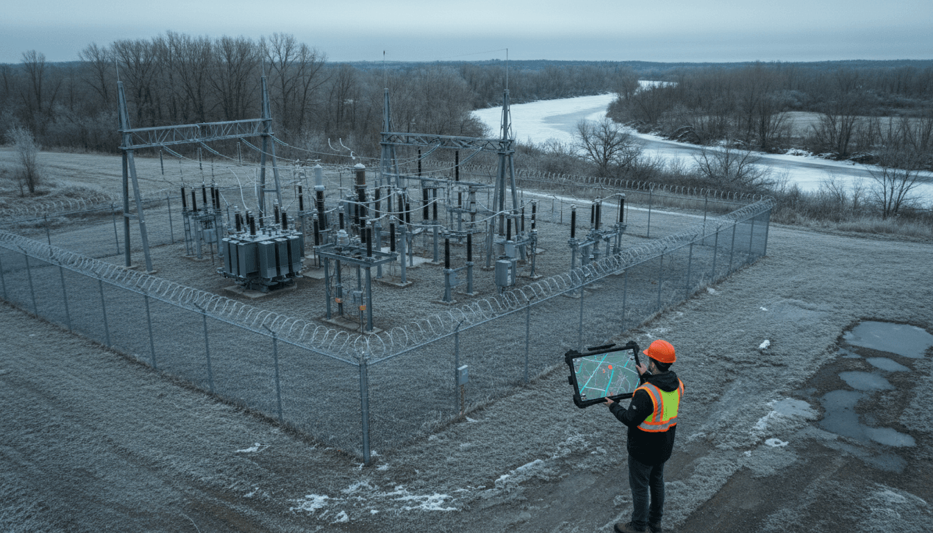
GPS is excellent—until it isn’t. Interference, urban canyons, canopy cover, and equipment constraints create real-world gaps. In defense contexts, the risks include jamming and spoofing. In utility contexts, the risks are more mundane but just as operationally painful: crews receive photos via text with no coordinates, asset IDs don’t match the field reality, or a storm knocks out connectivity right when a dispatcher needs certainty.
A fast image geolocation model changes the workflow from “call around and triangulate” to “submit a photo and get a candidate location list immediately.” The speed matters because operational decisions happen in minutes:
- Emergency restoration: a crew sends a photo of a damaged transformer bank; dispatch needs to confirm which structure it is.
- Wildfire and public safety power shutoffs: rapid validation of reported hazards reduces patrol time and improves situational awareness.
- Security investigations: a photo of a breached fence line or suspicious vehicle needs rapid location context.
The key point: this isn’t a replacement for GPS. It’s a redundancy layer—similar to how utilities treat SCADA telemetry versus field confirmation.
The research breakthrough: smaller models, faster matching
Answer first: The novelty isn’t “geolocate images” (that’s been done); it’s achieving strong accuracy with far less memory and far lower latency.
The RSS source frames the approach through a GeoGuessr-style challenge: given a street-level image and a database of aerial imagery with known coordinates, can the system find the match? Many systems can. What stands out here is the performance profile:
- Model size: about 35 MB (versus 104 MB for the next smallest model the authors compared)
- Matching speed: around 0.0013 seconds per match (compared to about 0.005 seconds for a runner-up in the paper’s comparisons)
- Accuracy: up to 97% for an early-stage narrowing step (with a 180° field of view), and about 82% for exact location
Those numbers matter more than they sound. Smaller models fit on constrained hardware. Lower latency enables real-time use (or near-real-time) in the field. And accuracy at scale determines whether teams trust it enough to operationalize.
Deep cross-view hashing, explained like you’d explain it to an engineer
Answer first: The system turns both street photos and aerial images into compact “fingerprints,” then compares fingerprints instead of raw pixels.
Traditional image matching can be slow because it tries to compare high-dimensional visual information directly. The technique described—deep cross-view hashing—does something more practical:
- A model learns to extract landmark-like features (roads, rooftops, intersections, lot shapes) from both perspectives.
- It converts each image into a hash code—a compact numeric string you can compare quickly.
- For a new street photo, it searches the aerial database for the nearest hash codes, returning top candidates.
One expert quoted in the source likened the hash to a fingerprint. That’s a good analogy. A fingerprint isn’t the whole person; it’s a compact identifier that’s fast to compare.
Why a vision transformer helps
Answer first: A vision transformer is good at learning relationships among image patches—useful for recognizing the same place from different viewpoints.
The model uses a vision transformer (ViT), which splits an image into small patches and learns patterns across them. For cross-view problems, this matters because the same “place” looks different from the street than from above:
- From the ground you see façades, signs, fences, and perspective.
- From above you see roof geometry, road layout, and spatial context.
A model that learns to ignore viewpoint “superficial differences” and emphasize shared structure is exactly what cross-view geolocation needs.
Utility operations: where this becomes practical fast
Answer first: Lightweight image geolocation supports field navigation, asset mapping, and rapid validation during outages—especially when data quality is messy.
Energy and utility organizations already use remote sensing and AI for vegetation management, storm assessment, and asset analytics. The missing piece is often closing the loop between what’s in the GIS/asset registry and what’s happening on the ground.
Here are the most immediate operational use cases.
1) GPS-denied or GPS-degraded field work
Field crews operate in areas where GPS can be unreliable: dense cities, steep terrain, heavy canopy, or during severe weather when networks are strained. A phone photo of a pole-top configuration or a damaged service drop can be visually matched to aerial context to validate location.
If you’re building resilient operations, treat this as positioning redundancy:
- GPS/RTK when available
- Map matching from vehicle telemetry
- Image-based geolocation as a fallback when metadata is absent
2) Faster asset mapping and “unknown asset” triage
Most utilities have some version of this problem: a photo arrives, the asset ID is missing, the pole tag is unreadable, and the crew is on the clock.
A fast geolocation step can return:
- the top 5 candidate aerial matches,
- a weighted average estimate (as described in the research),
- and a confidence score that helps dispatch decide whether to route a crew or request more evidence.
This works especially well for visually distinctive infrastructure: substations, large pad-mount transformer clusters, switching yards, major feeders, and corridor features.
3) Emergency response: speed beats elegance
Emergency response workflows are allergic to heavy infrastructure. If a model is small enough to run on edge devices (or in bandwidth-constrained environments) and fast enough to respond instantly, it fits how real incident response works.
That’s why the model’s memory savings matter. A 35 MB model is easier to deploy across:
- rugged tablets,
- offline-capable mobile apps,
- vehicle gateways,
- portable command center kits.
When minutes matter, “small and fast” wins.
Defense & national security: the same technique, higher stakes
Answer first: Image geolocation supports intelligence analysis and mission planning when images lack metadata—and it can work even when adversaries try to hide location.
The source mentions defense relevance directly: analysts often receive photos without reliable metadata, and need to infer location using reference overhead imagery. That basic problem hasn’t gone away; it’s expanded with drones, body-worn cameras, and open-source intelligence.
In contested environments, image geolocation contributes to:
- Intelligence triage: quickly narrowing where an image was taken so human analysts can focus on higher-value reasoning.
- Operational deconfliction: validating that a photo or video corresponds to an authorized area of operations.
- Infrastructure protection: identifying threats near critical energy sites (pipelines, substations, LNG terminals) from partial imagery.
One stance I’ll take: speed is a security feature. The faster you can place an image, the less time you spend making decisions in uncertainty.
The practical limitations (and what utilities should ask for)
Answer first: Seasonal variation, cloud cover, and domain shift can break image geolocation; utilities should demand robustness testing tied to their service territory.
The research summary itself flags a key gap: the authors didn’t fully study realistic challenges like seasonal variation or occlusions such as clouds. For utilities, the list of “things that break computer vision” is longer:
- snow cover that changes roof/road contrast
- leaf-on vs leaf-off canopy (huge for distribution corridors)
- wildfire smoke haze
- new construction that invalidates older aerial basemaps
- camera quality differences across field devices
- nighttime images and low-light glare
If you’re evaluating image geolocation for grid operations or critical infrastructure security, ask for proof in conditions that resemble your reality.
A procurement-ready checklist
Here’s what works in practice when you move from demos to deployment:
- Territory-specific evaluation: test against your own aerial basemap sources and your own field photo mix.
- Confidence + abstention: the model must be allowed to say “I don’t know” when confidence is low.
- Top-k results, not single answers: returning the top 5 candidates aligns with dispatch workflows.
- Latency targets: define requirements like “<50 ms on-device” or “<300 ms round-trip” depending on connectivity.
- Privacy and governance: treat field photos as sensitive operational data; apply retention limits and access controls.
This is where the “small model” advantage compounds: it’s easier to deploy securely and keep local.
People also ask: quick answers for decision-makers
Answer first: These are the most common adoption questions—answered plainly.
Does image geolocation replace GIS and asset registries? No. It complements them by helping you reconcile what the photo shows with what the registry claims.
Can this run on the edge for critical infrastructure? A 35 MB model is within edge feasibility for many modern devices, but actual feasibility depends on your compute, battery, and offline requirements.
Is 82% “exact match” good enough? For automation-only decisions, usually not. For decision support—routing, triage, validation—it can be extremely useful, especially if the model returns multiple candidates and a confidence score.
What’s the biggest hidden risk? Domain shift. A model trained on certain countries, seasons, and basemap types can degrade quickly elsewhere.
Where this goes next for smart grids
Image geolocation is heading toward a utility-grade capability: fast, compact, and operationally useful. The next step isn’t chasing another percentage point on a benchmark. It’s building end-to-end workflows: capture, locate, validate, dispatch, and audit.
For teams working at the intersection of AI in defense & national security and critical energy infrastructure, the overlap is obvious: the grid is both a service and a strategic asset. Tools that improve location certainty—especially under degraded conditions—are a direct investment in resilience.
If you’re exploring AI for field operations, start small: pick one incident type (storm damage photos, substation security events, or vegetation hazards), build a test set, and measure how often image geolocation reduces time-to-locate. Then ask the forward-looking question that matters: What would change operationally if “where was this taken?” became a 1-second answer—even when GPS and metadata aren’t there?