Germany’s €1.7B SAR buy shows how AI-driven ISR is becoming a tactical tool for NATO’s eastern flank—turning imagery into fast, trusted decisions.
Germany’s $2B SAR Network: AI ISR at NATO’s Edge
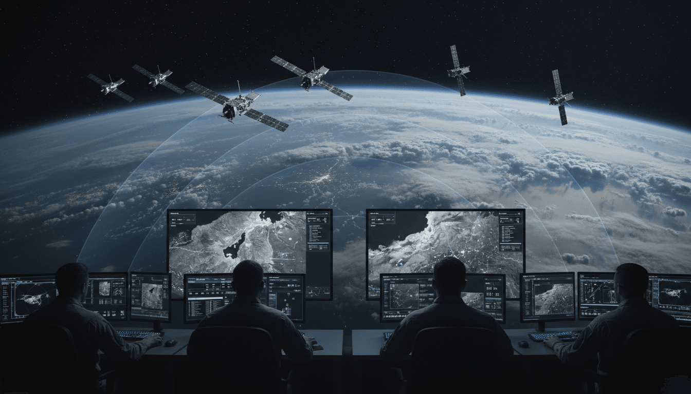
€1.7 billion is a loud number in any defense budget. Germany just put that money behind a specific idea: persistent, all-weather surveillance from space that’s operationally useful at the tactical level—not just a strategic “nice to have.” The contract awarded to ICEYE and Rheinmetall for a new synthetic aperture radar (SAR) satellite constellation is a clear signal that European defense planners are done waiting for perfect conditions, perfect access, or perfect timelines.
This matters for one reason that doesn’t fit neatly into a press release: the satellite isn’t the product anymore—decision-speed is. A SAR network that can collect through clouds and darkness is powerful. A SAR network that can also triage, flag, and route imagery using AI-driven image evaluation becomes something else entirely: a practical ISR layer for deterrence on NATO’s eastern flank.
Germany’s program—scheduled to run from the end of 2025 through 2030, with first satellite production beginning in Q3 2026—isn’t just a space procurement story. It’s a case study in where the “AI in Defense & National Security” conversation is heading next: ISR architectures where AI is built into the service model, not bolted on later.
Why Germany is buying SAR now (and why it’s not just “more satellites”)
Germany’s decision is a response to a simple operational reality: you can’t deter what you can’t see, and you can’t react to what you see too late. Optical satellites are excellent—until weather, smoke, or darkness shows up. SAR satellites don’t have that constraint. They’re the backbone for persistent monitoring when conditions are messy (which, in real crises, is most of the time).
The Rheinmetall/ICEYE contract explicitly ties the constellation to protecting Germany’s “Lithuania Brigade” (45th Armoured Brigade) and strengthening NATO’s eastern flank. That connection is telling. Germany isn’t framing space ISR as abstract national power; it’s tying space directly to a forward-deployed, heavy maneuver unit and the deterrence problem set in the Baltics.
The European strategic autonomy angle is real—and accelerating
The deal also fits into Europe’s broader push for strategic autonomy in space. For European militaries, autonomy doesn’t mean operating in isolation from the United States; it means having assured access to ISR and the ability to set priorities without negotiating bandwidth during a crisis.
The trend line is obvious. ICEYE has announced major European defense deals in 2025 alone, including:
- Poland: ~€200M for an initial three SAR satellites (with options for more) and a mobile ISR capability
- Netherlands: €158M for four SAR satellites (25 cm resolution mentioned), plus ground segment and an AI-driven imagery intelligence hub
- Finland: ~€158M for SAR satellites and options to extend lifecycle/expand
- Portugal: a first-ever direct satellite procurement for the Portuguese Air Force (value undisclosed)
Germany’s award is larger and more structurally important because it pairs a SAR provider with a major defense prime and sets up an exclusive constellation service model.
SPOCK-1: What Germany is actually buying (hint: it’s a service, not a spacecraft)
Germany’s new constellation is called SAR Space System for Persistent Operational Tracking Stage 1 (SPOCK 1). The contract structure highlights a modern procurement pattern: the joint venture owns and operates the constellation, and the customer buys the capability as an end-to-end service.
That service includes:
- Satellite operations
- Ground station management
- AI-driven image evaluation
This is a bigger shift than it looks.
In older ISR models, government customers often owned satellites and then had to build (or integrate) the ground processing, analyst tooling, exploitation workflows, and dissemination paths. That approach creates bottlenecks—especially when imagery volume grows faster than analyst headcount.
A service model can work better for operational users if it delivers two things consistently:
- Time-to-tasking: How quickly a unit can request coverage and get collection
- Time-to-trust: How quickly commanders can believe what they’re seeing and act on it
SPOCK-1 appears designed around those two metrics.
Why SAR constellations are moving to LEO
Low Earth orbit (LEO) constellations allow more frequent revisits and better responsiveness than a small number of exquisite satellites. For persistent operational tracking, LEO is the pragmatic choice.
But LEO also creates a new problem: you get more images than humans can realistically triage. That’s where AI becomes non-optional.
The AI piece: “AI-driven image evaluation” is the whole point
If you read “AI-driven image evaluation” and think “nice analytics feature,” you’re underestimating the operational impact.
SAR data is information-dense and difficult to interpret at speed—especially for non-specialists. SAR imagery looks different from optical imagery, and raw outputs can be noisy depending on angle, surface properties, and environmental factors.
AI changes the economics and tempo of SAR exploitation by doing the first pass at machine speed.
What AI can do well with SAR imagery today
Deployed correctly, AI can deliver consistent gains in ISR workflows:
- Automated change detection: Flagging new tracks, fresh earthworks, altered bridge spans, new revetments, or moved vehicles between two collections
- Object and pattern recognition: Identifying likely vehicle classes, vessel types, or aircraft shapes (with appropriate confidence scoring)
- Anomaly triage: Prioritizing “unusual” activity so analysts don’t waste time on normal patterns
- Cross-cueing: Using SAR detections to retask other sensors (optical, SIGINT, UAS) for confirmation
- Near real-time alerting: Pushing notifications to operational users when predefined triggers occur
Here’s the one-liner I keep coming back to:
SAR gives you coverage. AI gives you relevance.
Without relevance, you get a data lake that turns into a decision swamp.
The hard part: AI in ISR fails when teams ignore operations
In defense programs, AI often stumbles for predictable reasons:
- Models are trained on “clean” datasets, then deployed into messy real-world conditions
- Confidence scores aren’t communicated clearly to users
- There’s no feedback loop from analysts back into model improvement
- The workflow stops at “detection” and doesn’t include dissemination, fusion, and auditability
Germany’s approach—bundling AI evaluation into the service—creates a chance to build the workflow as a whole product, not a science project.
What this means for NATO’s eastern flank (and the Lithuania Brigade)
The Lithuania Brigade is expected to reach around 4,800 personnel when fully operational, and it’s Germany’s first permanently based unit of that size outside Germany since World War II. That’s not symbolism; it’s posture.
Persistent ISR matters for a forward brigade because it supports:
- Indications and warning: spotting unusual massing, logistics surges, or new air defense deployments
- Route and area monitoring: verifying mobility corridors, identifying new obstacles or construction
- Counter-sabotage awareness: detecting changes around depots, railheads, or key infrastructure
- Exercise realism and readiness: improving training and operational planning with real terrain and activity patterns
And SAR’s all-weather nature matters in the Baltics because weather is not a rounding error—cloud cover and limited daylight are routine.
Deterrence is partly a data problem
Deterrence isn’t only about capabilities; it’s about credible awareness and response timelines.
If a potential adversary believes you can:
- detect meaningful changes quickly,
- confirm them reliably,
- and respond fast,
…then their cost to conduct “ambiguous” activity goes up.
That’s why AI-enabled ISR is becoming a frontline deterrence tool, not just an intelligence community asset.
From SAR-Lupe to SPOCK-1: modernizing a fragile ISR baseline
Germany’s current SAR constellation, SAR-Lupe, dates back to launches between 2006 and 2008. That’s ancient in space systems terms. Germany also has follow-on satellites known as SARah, and public reporting in 2025 noted they faced antenna deployment issues until recovery actions brought them into service.
That context matters: resilience and continuity are part of the requirement now.
A modern constellation strategy typically aims for:
- More satellites (distribution): fewer single points of failure
- Faster replenishment: the ability to replace losses or failures on operational timelines
- Operational integration: tasking, exploitation, and dissemination designed for users who don’t have time to wait
SPOCK-1 fits that direction.
Practical lessons for defense and national security leaders buying AI-enabled ISR
If you’re advising a ministry, a program office, or an operational command on AI-powered ISR, this contract offers a few concrete procurement lessons.
1) Buy outcomes, not imagery volume
More images aren’t the goal. Better decisions are.
Write requirements around:
- time-to-tasking
- time-to-first-insight
- false alarm rates and confidence scoring
- auditability (why the model flagged something)
- dissemination latency to operational users
2) Treat the ground segment as the main weapon system
Satellites collect. Ground systems win.
The differentiator is:
- compute at the edge (or near-edge)
- automated triage pipelines
- fusion with other intelligence sources
- user interfaces designed for the tempo of operations
3) Build a feedback loop that analysts actually use
AI for ISR improves when humans can correct it quickly.
The workflow should make it easy to:
- tag false positives
- confirm true detections
- capture new patterns of life
- retrain models on mission-relevant data
4) Plan for contested operations
A SAR constellation supporting NATO’s eastern flank has to assume friction:
- jamming and interference attempts
- cyber threats to ground stations and processing pipelines
- misinformation campaigns aimed at discrediting ISR outputs
If your AI can’t produce trustworthy outputs under pressure—and if you can’t prove provenance—you’re building a vulnerability.
Where this goes next: AI-enabled SAR as a standard layer of defense ISR
Germany’s €1.7B award to ICEYE and Rheinmetall is a visible marker of a broader shift: ISR is becoming an always-on utility, and AI is the mechanism that makes that utility usable at scale.
Within the “AI in Defense & National Security” series, this is the cleanest example of a pattern I expect to define the next few years: sensor proliferation paired with AI triage and operational distribution. The winner won’t be whoever collects the most data. It’ll be whoever turns collection into trusted action fastest.
If you’re building or buying AI-enabled ISR—whether for a national force, a joint command, or a defense integrator—now’s the time to get serious about workflows, confidence, and resilience. The satellites are only the start.
Where do you see the biggest bottleneck in your own ISR pipeline today: collection, processing, analyst capacity, or dissemination to operators?